Wednesday, June 28, 2023

Watson Lake to Destruction Bay to Tok, Alaska, OMG

Let’s refer to this leg of the trip as, “Are you Freaking Kidding Me!”

Ok, we hav all done this. On our road trip during a summer vacation, tooling down Interstate (insert number here) and we come to the all to familiar orange cones or barrels.  It’s highway repair time in the summer.  We bitch & grumble as we slow down change lanes a bazillion times, but we get through.

Well, let me tell you about the Alaska Highway in the summer.  I already told you about all the upgrades & downgrades, some pretty steep.  I’ve mentioned the rock roads & dust.  But after Watson Lake you get into FROST HEAVE country.  What is a frost heave you ask?  These are large grooves, ruts, depressions, and humps across the pavement as a result of the permafrost melting/shifting. Think of a frost heave as an oversized speed bump or depressions.  Permafrost??  Well, the ground 15-20 feet from the surface never thaws.  But the top does, and while it does it slips slides, cracks & heaves.  Destroying the road above it.

So, all of a sudden, the road has a two-foot drop for 20 feet.  Sometimes they’re a two or three in a row, WTF?  They are hard to see, and the Highway department does try to mark them with small orange flags, I mean small.  So now we are driving slower, nowhere near the speed limit.  Trying to watch traffic ahead of us to see if they start bouncing like crazy.  

Well, the highway department repairs the frost heaves as best they can, but remember we are in the middle of freaking NOWHERE, they have very limited facilities & supplies.  So, what they do is basically destroy the road and rebuild it with the existing gravel.  So that explains the endless miles of dusty gravel roads.  

So the road from Watson Lake is 168 miles.  My RV Trip Wizard said three hours of driving time. Four and a half hours later we pulled into the “town” of Destruction Bay, population forty-two.  Not too bad, lots of gravel roads, dusty bumpy, more like driving on a washboard, but we made it.  Whew

Saw a couple of bears, pretty flowers, well fireweed.


And of course, gravel roads.  The issue with all the gravel roads is rocks that get tossed in the air by your RV, which can then hit your tow car, and in our case our brand new 2023 Tahoe. Yeah, I know what dumbass takes a brand-new car to Alaska, but that’s another story. Plus, oncoming traffic tosses rocks in the air too.  The big trucks don’t slow down much so you have to move as far to the right to avoid windshield damage.

So, we have some defense for the tow car, it’s a horizontal net that fills the area between the RV & the Tahoe.  Plus, a vertical plastic shield on the front of the Tahoe for added protection.  Then surprisingly one more defense, lift the big mudflap at the back of the coach.  Doesn’t make any sense.  But on the advice of three separate friends that’s what I did I raised it up with bungee cords.  The results?  There were two coaches in our caravan that chose not to raise their mudflap.  They had rocks all over the hood of their tow car, plus a couple of chips.  Me? Not a mark & not a rock on the hood.  Hmmmmmm.  Doesn’t make sense, but who cares?  Liking the results.

So back to to the road.  Today was the trip from Destruction Bay to Tok, Alaska.  Notoriously the worst leg of the trip.  Only 225 miles, should take a little over four hours.  Not even close.  Pulled out of our overnight stay went 200 yards, first frost heave.  They were incredibly frequent, deep and long.  It was going to be a slow trip today.  We drove through the construction crews, who were completely destroying & rebuilding the highway.  Plus, a handful of traffic defiles, where they close one lane of traffic at a time & you have to wait for a pilot car to negotiate the construction.  And I mean you are driving through the middle of a construction zone, weaving between bulldozers & dump trucks.  Fresh gravel is not even compacted yet.


The above & below picture didn’t turn out as well as we hoped, Rita was bouncing around in her seat a lot.  We actually drove off the road on some whacked outside-road on the edge of the highway, I wasn’t sure we could do it, but the big rig in front of me did so we followed.  Again WTF??


This simple little trip took almost eight hours.  But we made it, CC & our Tahoe are FILTHY.  But it looks like it is damage free!  Tomorrow Fairbanks and CC gets a bath!  

P.S. we have to take these two sections of the highway home in about a month to get back to the States, yippee??

Sunday, June 25, 2023

Driving Down (actually up) the Alaskan Highway!

 First off an up date, if you read a previous post you might remember that we do rove though some snow, in June!  It turns out we got through the area just in time!  The storm dumped over 36 inches of snow!!  Dodged a bullet there!

Anyway we got a great start on the Alaskan Highway, passed a Mule Deer.  It was crazy, he was chasing a fox though a field right along the highway, we were able to get a picture of the deer, no fox, he was really hustling and made it to the tree line.

So, the Alaskan Highway is a two-lane road that sometimes resembles a regular highway, sometimes it resembles an oil & chat road, and then sometimes is a dusty rocky road.  It is constantly changing, winding, steep upgrades steep downgrades.  Tree lined with mountains surrounding you on both sides.  It’s absolutely beautiful.

Ok a good start!

A couple of curves 

Another curve

Another curve?

Starting to se a serious trend here.  But the road is pretty nice.

Let the bouncy gravel roads begin!

Pretty rough, doing about 15 mph.  DUSTY!

So, enough road pictures, you get the idea, there aren’t many straight aways.  Always up & down, so far top speed was 55 mph, slowest about 15 mph.

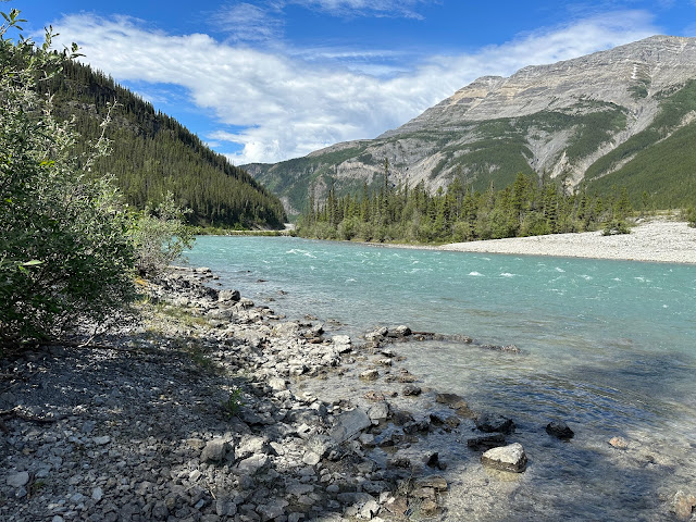
So, as you drive, you’re either driving up & over the mountains or driving between them.  When you’re driving in the valleys, you’re generally driving along either rivers or lakes.  I couldn’t pass up the chance to find a pull out (small gravel parking spots along the road).  I figured soaking my tired feet in an ice-cold mountain river would be invigorating.


Nice quiet shady spot.

Aahhh!

The river was cold, the lake was 1/2 a degree warmer.  Brrrrr

Mica telling me to take the dang picture so she can get out.  But she did go pretty far out, 5 more feet & it’s a sheer drop.

And the animals!  We saw dozens of bears, buffalo, caribou, elk and a rabbit.  Here’s some pictures.


So, when we left Dawson Creek driving 280 miles to Fort Nelson.  In between, NO towns.  Just a couple of outposts of one or two buildings.  And NO CELL SERVICE, just ask Mica.  And talk about desolate. Fort Nelson is a small little town with not much there, on to Liard Hot Springs for the night, 189 miles no towns.  Still no cell service or internet.  Just a small campground & park with hot springs.

We hiked to the hot springs, where there is a confluence of a hot spring & a creek.  The creek is cold water, so you find a spot between the two, that’s a comfortable temperature for & just relax.  It was nice, bit of a sulfur smell, but enjoyable.  


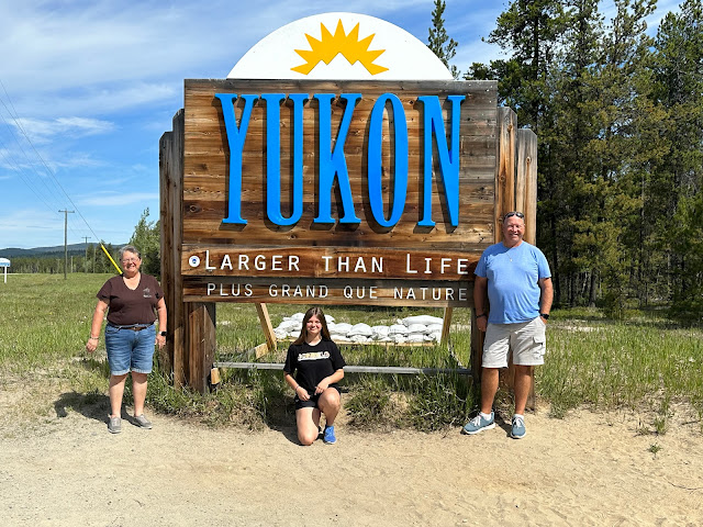
We drove on the next day to Watson Lake and our official entry into the Yukon Territory.  We sort of crossed back and forth six times between BC & YT, but now we’re here for a while.  It was only 129 miles to Watson Lake, so we took our time.  


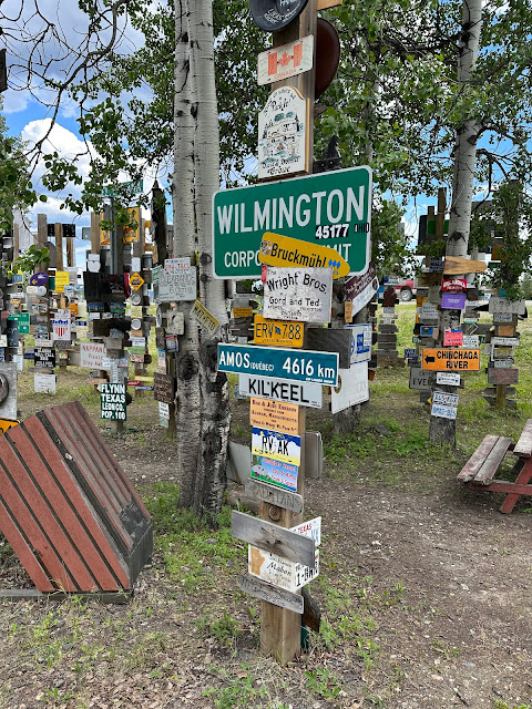
Once we got to Watson Lake we went to the famous “Signpost Forest”. It was started by some soldiers during WWII that were building the Alaskan Highway just to acknowledge their hometowns & how far they were from home.  Now it is a park full of signs of all sorts, over 10,000 of them some homemade, some professionally made, some last-minute improvised and of course some stolen.

There are hundreds or maybe thousands of government signs, usually city limit signs but all kinds.  From the US, Canada, all over Europe and all over the world.  It is the largest, unprosecuted, collection of stolen property in the world.  It is amazing.  It’s a maze of 10-foot-high signposts.  There are signs attached to every post & tree around.  Our caravan added one with all our signatures.  A couple of our group added their own.  Since Mica has been painting rocks, we added our rock to the park.


Anybody know these people from Collinsville?


By the way, Mica’s a Sax for the trip, the caravan made a mistake on her name tag & we just kept it.  Plus, it fit on the rock…..
This is the last of a couple of one-night stands.  We’re off to Whitehorse, YT for three nights.  Some sightseeing, rest & housekeeping.  On a side note, the days are really getting longer.  Sunrise is 4:29am & sunset is 11:35pm.  Here’s a picture out my bedroom window at 10pm.  

I told Mica, “lights out, it’s bed time” then realized we didn’t have any lights on cause it’s freaking daylight outside.  Pretty soon it will be basically daylight all day & night.

On to Destruction Bay!